


Voting District 0991130000002, Macomb County, Michigan
About
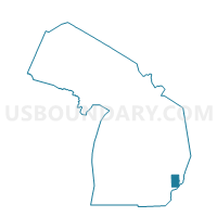
Outline

Summary
| Unique Area Identifier | 597893 |
| Name | Voting District 0991130000002 |
| County | Macomb County |
| State | Michigan |
| Area (square miles) | 8.10 |
| Land Area (square miles) | 7.94 |
| Water Area (square miles) | 0.17 |
| % of Land Area | 97.93 |
| % of Water Area | 2.07 |
| Latitude of the Internal Point | 42.82380840 |
| Longtitude of the Internal Point | -83.05482380 |
Maps


Graphs
Select a template below for downloading or customizing gragh for Voting District 0991130000002, Macomb County, Michigan


Neighbors
Neighoring Voting District (by Name) Neighboring Voting District on the Map
- Voting District 0991130000001, Macomb County, MI
- Voting District 0991130000003, Macomb County, MI
- Voting District 0998412000001, Macomb County, MI
- Voting District 0998412000005, Macomb County, MI
- Voting District 1250040000003, Oakland County, MI
- Voting District 1255982000002, Oakland County, MI
- Voting District 0991130000004, Macomb County, MI
Top 10 Neighboring County Subdivision (by Population) Neighboring County Subdivision on the Map
- Washington township, Macomb County, MI (25,139)
- Oakland charter township, Oakland County, MI (16,779)
- Bruce township, Macomb County, MI (8,700)
- Addison township, Oakland County, MI (6,351)
Top 10 Neighboring Place (by Population) Neighboring Place on the Map
Top 10 Neighboring Unified School District (by Population) Neighboring Unified School District on the Map
Top 10 Neighboring State Legislative District Lower Chamber (by Population) Neighboring State Legislative District Lower Chamber on the Map
- State House District 36, MI (107,643)
- State House District 46, MI (100,534)
- State House District 45, MI (100,485)
Top 10 Neighboring State Legislative District Upper Chamber (by Population) Neighboring State Legislative District Upper Chamber on the Map
Top 10 Neighboring 111th Congressional District (by Population) Neighboring 111th Congressional District on the Map
- Congressional District 10, MI (719,712)
- Congressional District 8, MI (707,572)
- Congressional District 9, MI (657,590)
Top 10 Neighboring Census Tract (by Population) Neighboring Census Tract on the Map
- Census Tract 2150, Macomb County, MI (4,887)
- Census Tract 2145, Macomb County, MI (4,299)
- Census Tract 2067, Macomb County, MI (3,596)
- Census Tract 1902, Oakland County, MI (3,336)
- Census Tract 1200, Oakland County, MI (3,115)
- Census Tract 2140, Macomb County, MI (2,648)